Millom Rural
CP in Millom parish, Allerdale above Derwent ward, Cumberland, created 1894, covering rural parts of Millom Above and Millom Below townships, most of township of Chapel Sucken (including village of Kirksanton) and chapelry of Thwaites. Name changed to Millom Without 1934, when boundary changes occurred. This entry covers townships of Millom Above, Millom Below, Chapel Sucken and Thwaites.
MILLOM ABOVE and MILLOM BELOW.
Acreage:
Millom Below township (most of which became core of Millom UD – see Millom) covered 2,658 acres [1,076 ha]; Millom Above township covered 3,397 acres [1,375 ha]. Stinted pasture at Millom Mains (254 acres [103 ha]) enclosed 1824. Common marshland at Arnaby Marsh and Pool House Bank in Millom Above (totalling c.1,500 acres [c.600 ha]) enclosed 1824.
Population:
declining from 1,489 in 1901 to 1,132 in 1931 (last census before boundary changes).
Landownership:
Millom Castle was seat of lords of seigniory of Millom, which covered all land between rivers Esk and Duddon. Lords of Millom retained immediate lordship over much of Millom Above and Millom Below townships. Millom was held by Godard de Boyville in early 12th century, descending to Joan daughter of Adam de Boyville whose marriage to John de Hudleston (d. c.1252) brought estate to Hudleston family, with whom it descended to William Hudleston (d. 1745), whose daughter Elizabeth and her husband Sir Hedworth Williamson, sold it 1774 to Sir James Lowther. Manorial lordship remained with Lowthers into 20th century.
Economy:
charter for market and fair granted 1251, though no medieval urban growth followed; market was described as ‘long discontinued’ in 1777. Early iron mining at Waterblean (and Hodbarrow from c.1840). Charcoal burning (said to have destroyed woodland in deer park) and iron making (recorded in name ‘Furnace Beck’) by later 17th century. Small harbour at Borwick Rails, from which slate and corn were shipped in mid-19th century. Quarrying for roadstone at Ghyll Scaur Quarry (in Millom Park) from the 1930s; visitor centre (Millom Rock Park) established there late 20th century.
Places of worship:
medieval parish church of Holy Trinity (next to Millom Castle), probably pre-Conquest foundation (Viking Age sculptural fragments preserved in fabric); restored 1930. Mission room at Hill built c.1900. Wesleyan Methodist chapel at Hill by 1901; now village hall.
Schools and other institutions:
school in Millom Below endowed by Joseph Hudleston (d. 1700) but endowment had been lost by 1818. School in Millom Above endowed by William Atkinson of Thwaites 1811. Castle school (Millom and Hodbarrow National School) by Holy Trinity church, built c.1858; closed c.1954. Elementary school at Hill, built 1883.
CHAPEL SUCKEN (including Kirksanton).
Acreage:
2,371 acres [960 ha], excluding detached portion at Stainton, near Waberthwaite (713 acres [289 ha]), transferred to Muncaster CP 1886. Haverigg village was transferred to Millom (q.v.) 1894. Open fields and stinted pasture at Kirksanton Haws (556 acres [225 ha]) enclosed 1803-4.
Population:
separate figures only available 1821-1871. Population stood at around 250-300 until 1860s; then rose to 648 by 1871, reflecting start of Haverigg’s growth into an industrial community as iron mining expanded.
Landownership:
manorial lordship descended with seigniory of Millom (see above).
Economy:
agricultural until 19th century. Lime-burning before mid-19th century. Iron mining north of Kirksanton 1879 to 1895; brewing and mineral water manufacture at Bank Springs Brewery, Kirksanton, by 1901. Airfield, RAF Millom, built on Kirksanton Haws 1939; closed to flying 1945; Haverigg wind farm built on site of airfield, 1992.
Places of worship:
place-name ‘Kirksanton’, recorded in Domesday Book, implies presence of early church: ‘chapel of Kirksanton’ recorded 1228 (no later records survive). Christ Church, Kirksanton, consecrated 1891; closed 1950.
Schools and other institutions:
HM Prison Haverigg opened 1967 on site of RAF Millom airfield training centre. Village hall at Kirksanton.
THWAITES.
Acreage:
4,392 acres [1,777 ha], including 1,635 acres [662 ha] of unenclosed common on Thwaites Fell and 122 acres [49 ha] of common marsh at Lady Hall Marsh.
Population:
separate census figures only available 1821-1861: rising from 315 in 1821 to peak of 364 in 1851, falling back to 350 in 1861.
Landownership:
manor of Thwaites held by Thwaites family from 13th century; sold by John Thwaites of Ewanrigg to Sir John Lowther 1627; his son sold manor to Sir William Hudleston 1664 but regained possession 1667; it remained with Lowthers into 20th century.
Economy:
farming; lime-burning. Iron making at Duddon furnace, established 1736; closed 1867. Woollen mill complex (carding mill, weaving shed, dye works and fulling mill) at Hallthwaites from 1820s; closed 1935. Brushstock and handle mill, Duddon Bridge, mid-19th century.
Places of worship:
chapel of ease of St Anne built 1715 (consecrated 1725); rebuilt 1807; current church built 1852-4.
Schools and other institutions:
school built by inhabitants before 1722; replaced by Thwaites Board School; now Thwaites Primary School. Buckman Brow school for girls, endowed and built 1845 by Frances E. Millers of Duddon Grove; closed c.1924. Parish library established 1757 but lost by mid-19th century. Public hall at The Green by 1901; extended c.1940s; now Thwaites Village Hall.
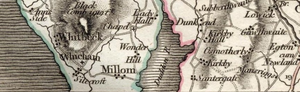
Map of Millom Above (Rural)
Township maps:
The area of Millom and Millom Rural CP comprised from 1934 parts or whole of four townships. The maps of three of these townships as they were in 1900 are given below.
Document- map_of_millom_above.pdf (722.32 KB)
- map_of_millom_above.pdf (722.32 KB)
The Place-names in Millom Rural
See the entry for Millom

