Carlisle
Cathedral city and county town of Cumberland.
Administrative history:
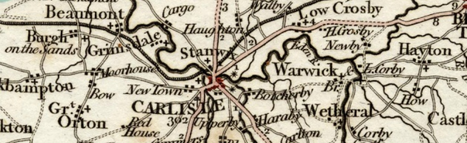
This entry covers four ancient territories: city of Carlisle itself and townships of Rickergate, Botchergate and Caldewgate, which together formed Carlisle CP, created 1904, covering 2,025 acres [819 ha]. Component territories are: City of Carlisle, which consisted of civil divisions of Eaglesfield Abbey (5 acres [2 ha] of extra-parochial land), St Mary Within (33 acres [13 ha]) and St Cuthbert Within (38 acres [15 ha]). Rickergate township in St Mary’s parish contained 358 acres [145 ha] before gaining part of Stanwix 1894 and thereafter containing 400 acres [162 ha]. Botchergate township in St Cuthbert’s parish covered 415 acres [168 ha]; Botchergate CP, created 1894, extended beyond bounds of township and covered 561 acres [227 ha]. Caldewgate township in St Mary’s parish covered 1,700 acres [688 ha], part of which (988 acres [400 ha]) was absorbed into Carlisle; in 1894 remainder became Belle Vue CP, much of which was, in turn, absorbed into Carlisle 1912.
Roman and medieval origins (to c.1300):
Carlisle’s origins lie in Roman settlement of LUGUVALIUM. Fort was established 72-3 AD on site now partly overlain by medieval castle. Civilian settlement or vicus grew up to east of fort, covering much of area later enclosed by medieval city wall (though it is unclear whether Roman settlement was walled). By 3rd century Luguvalium was important military base on Roman frontier and also a centre of administration as principal town of Civitas Carvetiorum (self-governing territory of tribal group known as Carvetii). It appears to have been prosperous and town in which a Romanised population survived into 5th century, well after end of Roman administration. Some sort of organised community existed 685, when, according to Life of St Cuthbert, Cuthbert visited Carlisle and met reeve; a ‘fountain’ was still functioning. Carlisle and a territory of 15 miles radius were granted to St Cuthbert by king of Northumbria before 685: it is likely that an Anglo-Saxon monastic community was placed there, probably in vicinity of later cathedral. Carlisle is said to have been destroyed by Danes c.875 and to have lain desolate until after Norman conquest. Archaeological evidence, however, points to some continuing occupation through 10th and 11th centuries. Re-birth of Carlisle and building of walls and castle are traditionally attributed to William II (Rufus) of England, who captured ‘the land of Carlisle’ in 1092, dispossessing native ruler, Dolfin, and fortifying town. Creation of medieval city probably dates from reign of Henry I, who founded priory 1122, embarked on building city walls and stone keep of castle, and in 1133 made Carlisle a bishop’s see. Claims of Scottish crown to Carlisle region posed a continuing threat until 1237(city was besieged by William, king of Scotland, 1173-4 and again by his successor, Alexander, 1216). Carlisle received its first charter from Henry II c.1158, granting merchant guild and other privileges. Walled city, covering 57 acres [23 ha], appears to have developed rapidly and there is evidence of medieval settlement in extra-mural suburbs of Rickergate, Botchergate and Caldewgate (though last was devastated by flooding 1484). Suburbs were used for distribution and treatment of wool and hides and some citizens grew cereals and pastured their livestock outside city walls. By 1237 city had become largely self-governing community. Wool was woven and dyed; leather was tanned and both commodities were exported to Ireland. Servicing castle garrison and priory and administering a large territory as shire town and cathedral city complemented industrial and trading economy. Henry III granted second charter 1251, to replace the first which had been lost by fire, as indeed was second charter in 1292, in a fire which destroyed much of city. Edward I granted new charter 1293 but also began to develop Carlisle as major military base in preparation for invasion of Scotland.
Border city (c.1300- c.1750):
From outbreak of wars with Scotland in 1296 until well into 18th century, Carlisle’s character was shaped by its proximity to Scotland and its role in guarding the Border. It remained a military city on a defended site: royal castle on its north-west edge and 16th-century Citadel at south-east end were connected by strong city wall, enclosing core of built-up area. Population estimated to have been c.1,500 in 14th and 15th centuries, sporadically swollen by military presence. Garrison provided townspeople with economic opportunities (if causing friction at times); some fine houses were erected in mid-14th century by well-to-do clergy and merchants and as townhouses for local gentry families. However, continuing instability of Border region in later 16th century, outbreaks of plague (particularly in 1598), and disruption caused by Civil War siege of city in 1645 combined to hold back Carlisle’s economy. By late 17th century, some evidence of increasing wealth. Carlisle served a wide region: despite its comparative isolation and poor transport links, its role was more than that of market centre for Solway lowlands. Thomas Denton noted 1688 that corn dealers (‘badgers’) from Northumberland came to Carlisle market and went home laden with corn and grain and that city’s three fairs included three-day horse fair in June and ‘great beast fair’ in August. City was a focal point in the cross-Border cattle trade which gathered pace after union of crowns. Eight trade guilds (merchants, tanners, skinners and glovers, butchers, smiths, weavers, tailors and shoemakers) continued to thrive. Population was probably around 5,000 by late 17th century (in 1688 Denton estimated 5,060 inhabitants in St Mary’s and St Cuthbert’s parishes combined), making it one of largest towns in north-west England. As well as trading function, it continued to house an increasingly wealthy clerical, military and legal elite by virtue of being centre of administration, as royal garrison, county town and cathedral city. Despite this, progress appears to have stalled by early 18th century. Travellers’ comments on Carlisle paint a bleak picture: Defoe visited in 1724 and reported that ‘the city is strong, but small, the buildings old, but the streets fair ... There is not a great deal of trade here either by land or sea, it being a mere frontier’, while in 1759 a merchant from Bristol called it ‘a small deserted dirty, poorly built and poorly inhabited’. Seeds of change were visible, however, in textile ‘factory house with looms’ established on site of fulling mill and dye house at Abbey Mill by Deulicher brothers 1724.
Industrial and railway city (c.1750-1914):
Improved transport links (completion of military road to Newcastle 1750 and spread of turnpike roads) from mid-18th century enabled Carlisle to share in industrial revolution. It grew significantly across later 18th century, population of city and its suburbs exceeding 10,000 by 1801, with greatest growth occurring in new industrial areas outside city walls. Industrial base initially centred on water-powered textile mills specialising in finishing of linen cloth and in calico printing. Calico printing started 1761 and gingham, check and bleaching establishments set up shop. Cotton spinning mills were established from 1790s, largest being steam-powered New Mill or Slater’s Mill (1802) and Shaddon Mill (1836). Although print works closed in early 19th century, dyeing and cloth finishing (‘beetling’) expanded. Tanning, brewing (on industrial scale from 1756), hat-making (from 1760s), printing (from 1799), iron and brass founding (from 1804), soap-boiling (by 1794), and biscuit-making (Carr’s biscuit factory established 1834) all added to industrial mix. Major transformation took place in 1813, when city walls were finally demolished, heralding final transition of Carlisle from insular enclosed community to fully-fledged modern city. From 1804 corporation lit and paved the streets; from 1819 it was lit by gas. Industry remained dependent on road transport until canal to Port Carlisle was dug 1823. On eve of railway age, Carlisle was a thriving regional centre: Carlisle gained its first bank 1787 and its first newspaper 1798. There were three banks: Carlisle Old Bank was a private bank but Carlisle City & District Bank (established 1836; amalgamated with London & Midland Bank 1896) and Carlisle & Cumberland Banking Co. (established 1835) issued their own notes. Carlisle Journal, established 1798, was first of plethora of newspapers, most of which were short-lived. Those which endured were the Journal itself, Carlisle Patriot (first issued 1815); Carlisle Examiner and Northern Advertiser (1857-1870); and Carlisle Express (founded 1861), which merged with Carlisle Examiner 1870 to form Carlisle Express and Examiner; which, in turn, merged with Carlisle Journal 1913. Carlisle Patriot amalgamated with East Cumberland News and became Cumberland News, which absorbed Carlisle Journal 1968. Railway connected Carlisle to Newcastle 1838 and city soon became a hub in expanding railway network, being served by seven different lines. Maryport railway opened 1845; that to Lancaster 1846. Southern section of Caledonian Railway opened 1847, with through services to Glasgow and Edinburgh from 1848; Glasgow and South Western Railway followed 1851. Port Carlisle canal was replaced by railway to Silloth 1856 and Midland Railway’s Settle-Carlisle line opened for freight traffic 1875. Citadel station, built 1847-8, became hub of railway network. Carlisle grew rapidly across 19th century, swelled by Scottish and Irish immigrants: by 1851 city had over 25,000 inhabitants; by 1901 over 45,000. By 1860s textile industry was in decline and number of handloom weavers was dwindling rapidly but railways gave employment in their own right and also opened up markets for firms that were to come to prominence in second half of 19th century. Impact of railways on employment was significant: in 1917 over 14% of all households were headed by a railway worker and in 1921 over 20% of male employment was in the transport and communications industries. Carlisle’s industrial base diversified: Hudson Scott’s printing works developed tin-plate decoration and, from 1886, manufacture of tin boxes; number of foundries increased and specialised engineering, such as crane manufacture (from 1858), developed; John Laing set up small building firm 1848, which was to become one of country's leading building and civil engineering contractors. On eve of First World War Carlisle was major industrial city, as well as continuing to serve as county town and seat of an expanded diocese. Modern Carlisle (since 1914). In first half of 20th century, railways, engineering and metal trades remained major industries. Textile industry, in severe recession at beginning of century, made a limited recovery during inter-war years, but dwindled after 1945, though some specialised activity continued, such as Linton Tweeds, which took over Shaddon Mill 1912. Some major firms closed: last crane built at St Nicholas engineering works 1987; Victoria ironworks closed 1998. Losses were counteracted to some extent by growth of new firms, including Kangol, Pirelli and Nestlé. In 1927 new power station was erected at Willowholme and connected to national grid. Electric trams ran from city centre to suburbs from 1900, but by 1931 were judged to cause congestion and were taken out of service. Decline in railway transport in mid-20th century reduced Carlisle’s role as transport hub; two of its lines closed in Beeching cuts: Carlisle-Silloth line (1964) and Waverley line (1965). Redevelopment of city centre from 1960s radically altered townscape: Civic Centre built 1960-3; inner ring-road opened 1971; increasingly derelict 19th-century lanes and courts redeveloped as The Lanes shopping precinct 1984.
Places of worship:
City: finds of Northumbrian age sculpture suggest Anglo-Saxon monastic site encompassing site of cathedral and St Cuthbert’s church. Church on cathedral site re-founded as Augustinian priory 1122, becoming see of diocese of Carlisle 1133. Parish church of St Mary was within nave of Cathedral until 1870, when new church of St Mary built on east of cathedral close; demolished 1954. St Cuthbert's Church, almost certainly a pre-Conquest foundation, rebuilt 1778 on site of previous structure. Within walls of medieval city were also St Alban’s chapel, possibly also pre-Norman foundation, which became chantry and was dissolved 1549, and two friaries, of Franciscans (or Greyfriars), founded 1233, and Dominicans (or Blackfriars), also established in 1230s. Nonconformist places of worship in city centre included: Quaker meeting house, at first in Abbey Close, 1653 to c.1660; re-established in city 1693; new meeting house, Fisher Street, built 1702; replaced by one on another site in Fisher Street 1776; in turn replaced by present meeting house on former burial ground at end of Fisher Street, 1963. English Presbyterian chapel (formerly known as ‘old Scotch’ Presbyterian chapel), Fisher Street, built 1730s, when congregation removed from their former chapel near west wall; rebuilt 1894; demolished 1986. Chapel in Annetwell Street (demolished by 1901), used before 1817 by Lady Glenorchy’s Connexion; then by Independents, until Congregational chapel (now United Reformed Church), Lowther Street, built 1843. Church of Scotland, Chapel Street, built 1834. First Methodist chapel built in Fisher Street 1786; replaced by new chapel on site of present Methodist Central Hall, Fisher Street, 1817. Other Methodist chapels included United Methodist Chapel (formerly Wesleyan Association chapel), Lowther Street, erected 1837. Baptists met in Abbey Street from 1809 and rented former Methodist chapel, Fisher Street, after 1817; Berian Baptists, built chapel in Tower Street 1818. Roman Catholic church, West Walls, built 1799; replaced by church in Chapel Street 1824. Other places of worship included Salvation Army barracks, Annetwell Street, replaced by new Citadel, Abbey Street, 1972; several groups of Christian Brethren by 1900; Elim Pentecostal Church, which met in building in West Walls from 1927 and moved to former Anglican church of St Paul 1979; Elim Free Church established after a secession 1939; and Seventh-day Adventist Church, opened 1944 in hotel room in West Walls; moved to former Jehovah Witness meeting place; purchased property in Finkle Street, 1982. Rickergate: new Anglican district churches of St Paul, Lonsdale Street, (since 1979 Elim Pentecostal Church), built 1869-70 and St Aidan, Warwick Road, built 1899-1902. Roman Catholic church of St Mary & St Joseph, Warwick Square, built 1891-3; English Presbyterian church (now St George, United Reformed Church), Warwick Road, built 1862-3; Primitive Methodist chapel, Cecil Street, built 1852; demolished 1966; Baptist church, Aglionby Street, built 1887-8. Botchergate: new Anglican district churches of Christ Church, Botchergate (erected 1828-30; closed 1938; demolished 1953); St John, London Road (built 1867) and St Stephen, James Street (built 1865; demolished 1964). Congregational (formerly Evangelical Union) chapel, Cecil Street, built 1860. Wesleyan Methodist chapel, Union Street, opened 1891; closed 1990; demolished 1991. Unitarian church, James Street, built 1889; closed. Mission church on Blackwell Road by 1901; St Herbert’s church, Currock, dedicated 1932. Caldewgate: medieval chapel of Holy Trinity, Caldewgate, recorded from 14th century (located in Paddy’s Market area); its name preserved in new (Anglican) Trinity Church, completed 1830 as chapel of ease to St Mary’s; spire removed 1947; demolished 1982. Other Anglican district churches of St James, St James’ Road, built 1865-7; St Barnabas, Newtown, built 1935-6. Primitive Methodist chapel opened in Willowholme, 1826; moved to Cecil Street, 1852. Wesleyan Methodist chapel, Caldewgate, opened 1865. Methodist Church, Wigton Road, built 1929. Church of Christ chapel, Denton Street, built 1881; demolished 1966. Congregational chapel (now Carlisle Christian Fellowship), Charlotte Street, built 1860-1. St Bede’s RC Church, Silloth Street, built 1866 as school an chapel; new church of St Bede, Wigton Road, built 1959.
Schools:
City: Carlisle Grammar School (usually called High School until 1880), recorded as early as 1186; new school built in West Walls 1806; replaced by new building there 1832. Moved to Strand Road 1883 (see below, Rickergate). Central School for boys and girls, a large structure at West Walls, built 1812 on ground given by corporation. Fawcett School (boys and girls), West Walls, opened 1851; took over buildings of Central School some time before 1884. St Patrick’s Schools for boys and girls, Spring Gardens, founded 1825 for education of children of all denominations; enlarged 1844; moved to new building 1908; became part of Cardinal Newman School (see below, Rickergate) 1968. British or Lancastrian School, for boys and girls, originated in Lancastrian School established 1811 in Watergate. British school, Mary Street, built 1834; closed 1885; demolished 1973. High School for Girls, Castle Street, opened 1884; removed to Lismore Place 1909 (see below, Rickergate). Academy of Arts, Finkle Street, established 1823, was forerunner of College of Art, Finkle St, founded 1856; moved to Tullie House (see below, Other Institutions) 1893, and from there to Stanwix (q.v.) 1951. Rickergate: Carlisle Grammar School, moved to new premises on Spring Garden Lane 1883 and to Strand Road (name changed to Trinity School) 1968. Carlisle and County High School for Girls, Lismore Place, opened 1909; became mixed school (St Aidan’s School) 1970; closed 2008. Cardinal Newman RC School, opened 1968. Further education classes previously held at Tullie House, moved to new Technical College (now Carlisle College), Victoria Place, 1954. Botchergate: Christ Church National School, completed 1830; St John’s National Boys’ school, Close Street, erected 1869. Board schools: Brook Street Board schools, built 1892. School of Industry, Botchergate, built 1806; active 1847. St Martin’s College took over City General Hospital site, Fusehill Street, after closure 2000; now campus of University of Cumbria. Caldewgate: mixed school in Shaddongate opened 1836, adjoining cotton factory of Peter Dixon and Sons, for ‘facilitating the education of the offspring of the operative classes’. Shaddongate Adult School and Reading Room founded 1857. Holy Trinity School, Caldewgate, built 1842; enlarged 1895; closed 1915. Caldewgate Ragged and Industrial School (also known as ‘Head’s School’), Shaddongate, opened by philanthropist George Head Head 1851; had closed by 1891. St Bede's RC School, opened 1866 as school chapel mission; new buildings 1883-4; enlarged 1889; old school closed 1962. Newcastle Street and Kendal Street Elementary School, for both boys and girls, built 1875. Board schools: Caldewgate School opened 1872; enlarged 1885; Caldewgate Junior School closed 1988, when combined with Caldew Lea School. Ashley Street Elementary School, for boys and girls, built 1895; closed 1988. Denton Holme schools (later Robert Ferguson schools), Morley Street, built 1879; senior mixed school, East Dale Street, built 1904; closed 1970. Belle Vue Primary School opened 1970.
Other Institutions:
Carlisle Castle: royal fortress since c.1100; keep begun 1122 by Henry I and completed by David I of Scotland; used as prison for border reivers and others in the turbulent 15th and early 16th centuries, when rule of law broke down across border region. Became military garrison in 1830s, with barrack blocks in outer bailey. Citadel built 1541-3 as independent fortress at vulnerable southern end of city walls; re-constructed 1804-1822 to form entrance to city. Assize courts, originally held in Guild hall, moved to Citadel 1811; western tower housed Crown Court, connected to goal by underground passage. Purpose-built gaol built close to Citadel 1688, replacing castle as county gaol. New gaol on Citadel site completed 1827; closed 1922; pulled down 1931. New Crown and County Courts, Earl Street, built 1990-2. Town Hall, housing corporation and mayor’s court and city sessions, built 1668-9 on site of medieval town hall; extended 1717 and 1825. Ground floor occupied by shops. Guildhall (or Redness Hall), built by Richard de Redeness after fire of 1392 (dated to 1396-1407); each of eight guilds had a room as meeting place. Guildhall Museum opened 1978. Covered market, replacing street market around market cross (‘Carel Cross’) which closed 1927, originated when butchers’ shambles were moved to Old Bluebell Lane 1799, to which butter and egg market were also moved 1854. New covered market opened 1889; refurbished from 1989. Civic Centre, at foot of Lowther Street, built 1960-3. Leper hospital of St Nicholas, Botchergate, probably founded in 12th century; survived Dissolution to be destroyed during siege of Carlisle 1645. Dispensary, founded 1782 in Abbey Street; moved into part of Tithe Barn 1825; new dispensary opened in Chapel Street 1855; absorbed into National Health Service 1948; sold 1962. House of Recovery (with the object of curing and preventing contagious diseases) established 1820 in building near Collier's Lane; moved to Crozier Lodge, beside Cumberland Infirmary, 1847; remained a fever hospital until at least 1910. Cumberland County Infirmary, Newtown Road, built 1830-2; extended 1870-4, 1908-13; new block opened 2000. Home for Incurables (Strathclyde House), Wigton Road, opened 1885; closed 1991. Cumberland and Westmorland Home and Workshop for the Blind established in West Tower Street 1872; moved to new premises in Lonsdale Street, built 1878-9; moved to Petteril Bank 1950s. Parish workhouses for St Mary’s parish built in Devonshire Walk 1780s; Caldewgate Workhouse, for St Cuthbert’s parish, built in Coal Fell 1829-30. Both closed and replaced by Carlisle Union Workhouse, Fusehill Street, built 1863-4, part of which became City General Hospital (later Carlisle Maternity Hospital) from 1937. It closed 2000; site was taken over by St Martin’s College (now University of Cumbria). St Mary’s Home for Penitents (for ‘reception and reformation of fallen women’), Coal Fell, opened 1872; laundry built 1894; home closed c.1920 but laundry continued; home re-opened at Coledale Hall, Belle Vue, 1926. Roots of Tullie House Library, Museum and Art Gallery can be traced back to several separate institutions in early 19th century. Carlisle Subscription Library, established 1768; moved into new premises on corner of English Street/Devonshire Street 1831; amalgamated with public library 1896. Mechanics’ Institute established 1824 in Castle Street; subsequently housed in the Athenaeum, Lowther Street, built 1840, also containing large lecture hall, exhibition hall and museum. Institute moved to Fisher Street 1850. In 1891 Mechanics’ Institute and Library were presented to corporation. Lord Street Reading Room, established 1848 in John Street, Botchergate; opened 1851. Its library was offered to corporation 1891 on condition city adopted Public Libraries Act. Museum founded by Carlisle Literary and Philosophical Institute 1835 was later transferred to the Athenaeum; collection was seized 1860 for non payment of rent and given to corporation who housed it in Finkle Street where it fell into disuse. Taken over by committee of working men 1874 and re-opened 1877. Tullie House was presented to Corporation 1890 and opened in as Museum and Public Library 1893, with an attached School of Art. In 1986 library moved to Globe Lane; museum redeveloped on Tullie House site; re-opened 1991. Macready Theatre, Blackfriars Street, built 1813-4; but had fallen into disuse by 1850s. Three theatres by 1860s: Theatre Royal, Swifts Row; Bijou Theatre in Mechanics’ Hall, Fisher Street; Matchbox Theatre, on The Sands (opened 1858; used by Salvation Army from 1880; demolished 1892). Her Majesty’s Theatre, Lowther Street, built 1874 as Victoria Hall; re-named 1879; closed 1963. Star Music Hall, Rickergate, opened 1877. Palace Theatre/Cinema opened as music hall 1906; closed as theatre 1932; reopened as cinema same year; reopened as The Studios 1970; demolished 2004. Star Picture Hall, opened 1912; changed name to the Rex 1932; became bingo hall 1962. City Cinema, English Street, opened 1915; closed 1960. Lonsdale Cinema opened 1931; closed 2006. Races held regularly from mid-18th century on course at the Swifts, beside River Eden, with a grandstand built 1839; moved to Blackwell 1904 (see St Cuthbert Without). The Sauceries and the Bitts, open spaces beside Eden became public parks and Botchergate recreation ground, Fusehill Street, opened 1892. Local radio station, BBC Radio Carlisle (later renamed Radio Cumbria), began broadcasting from Carlisle 1973.

